
 (2).jpg)
The land
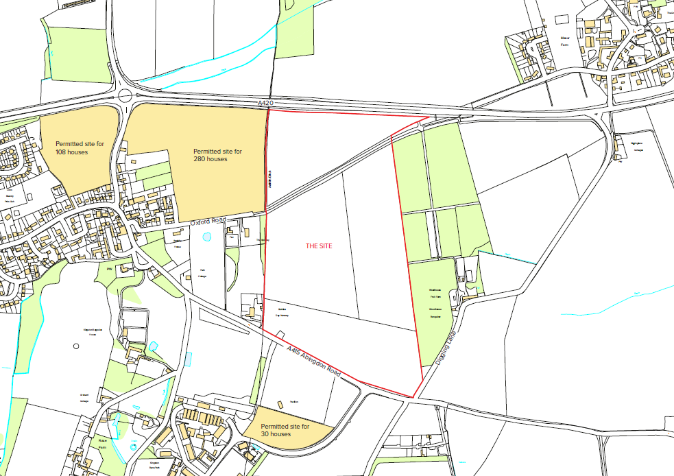
The land is located between the A420 (Oxford Road) and the A415 (Abingdon Road), just to the east of Kingston Bagpuize. The below map shows the boundary of the land, marked by a red line. The western boundary of the land also forms the boundary between the Parish of Fyfield and Tubney, in which the land sits, and the Parish of Kingston Bagpuize with Southmoor.
What have we proposed?
In July 2016 Lioncourt Strategic Land submitted plans for the land east of Kingston Bagpuize to Vale of White Horse District Council’s ‘Call for Sites’, to be considered for inclusion in Part 2 of the Vale of White Horse District Council Local Plan, which is expected to set out how the remaining housing needs of the District will be met, along with the Vale’s contribution to meeting Oxford’s unmet housing need. The land east of Kingston Bagpuize offers the opportunity for the Vale to meet some of these housing needs without encroaching on the Green Belt.
Our submission to Vale of White Horse District Council’s Call for Sites
The documents below were submitted in July 2016 to Vale of White Horse District Council in response to the Call for Sites. Please note that the plans therein were indicative only, and have since developed further through consultation with residents, community stakeholders, councillors and officers.
Baseline Analysis and Development Concept
Landscape, Ecology, and Heritage Briefing
 Copyright © 2002 - SP Broadway
All rights reserved. Web Designers - Say Web Design
Copyright © 2002 - SP Broadway
All rights reserved. Web Designers - Say Web Design